Item details: Carte Reduite des Costes De France et D'Espagne
£ 250.00
BELLIN, Jacques Nicolas
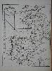
Carte Reduite des Costes De France et D'Espagne
Imprint: Paris, 1764
390 x 305 mm., in good condition.
A finely engraved sea chart of the waters of the English Channel, the Bay of Biscay and the Spanish peninsula extending eastwards to Toulon. It is from Jacques Nicolas Bellin's greatest atlas, the 'Petit Atlas Maritime'. Phillips 638 & 3508; Shirley BL M. Bell 5a; Nordenskiold Collection 1; National Maritime Museum no. 211.