|
|
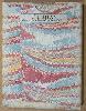
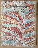
Imprint: London, Carington Bowles at his Map and Print Warehouse, No. 69, in St. Paul's Church Yard, 1785
Quarto (270 x 220 mm.), full contemporary tree calf, gilt ruled, rebacked with gilt ruled raised bands and gilt label to spine, corners with light wear, signs of light damage to back board. With 44 copper engraved maps in early outline colour. Overall a very fresh example.
A beautiful example of 'Bowles's New Medium Atlas'. This atlas was first published in 1767 as the 'Atlas Anglicanus' in response to Ellis popular English Atlas first published in 1765. The 'Atlas Anglicanus' like many projects at the time began life by being published in monthly numbers. Each contained three maps with, apart from the first, the part numbers being engraved on them. Until recently no example of the parts issue had been located and the only evidence we had for its issue came from a contemporary account of Gough and two located adverts. The presence of the same number engraved on three maps caused some confusion for earlier cartobibliographers, notably Chubb who surmised that they represented pigeon holes in the printing office! Shortly after production began, Emanuel Bowen (c.1693-1767) died; his death on 8 May 1767 was reported in the 'London Magazine'. The project was continued by his son Thomas (c.1733-90) although the issues were becoming somewhat irregular towards the end. Near completion Thomas Kitchin (1718-84) steps in and appears to buy the rights to the atlas, the last part is issued with a title page indicating Kitchin as sole publisher. Kitchin was originally apprenticed to Emanuel Bowen in 1732 and would marry his masters daughter, Sarah, in 1739. Quite soon the pupils output became prolific including several high quality English county atlases. Bowen was successful too and despite the death of Sarah in 1761 the ties between Bowen and Kitchin would remain close. But whilst Bowens wealth declined over the years Kitchin remarried in to a wealthy Baptist family. The maps are reductions of those published in the 'Royal English Atlas', themselves reductions of the 'Large English Atlas', both great atlases. Carington Bowles acquired the plates sometime before 1785 and immediately set about revising them. The title cartouche are all changed, the imprints brought up to date and all now are numbered upper right to 44. The compass roses are now more uniform in style throughout and distances have been erased being replaced by those from London to the major cities. The atlas faced stiff competition from the continued presence of the Ellis atlas and the introduction of the hugely popular 'New and Correct English Atlas' by John Cary in 1787. Bowles priced his atlas at £1 16s, whilst the Ellis was 10s 6d and even the new Cary atlas was £1 10s. This atlas is therefore considerably rarer than that of the Cary in particular. A particularly good example of the atlas. Provenance: with bookplate inside front cover of the Wild family of Canterbury and Lewisham. Chubb (1927) 232; ESTC T301089; Hodson (1984-97) 256; Shirley (2004) T.Bow 5a; Worms & Baynton-Williams (2011).
Stock number:7340.
|
|
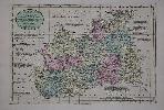
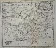
Imprint: London, Carington Bowles, 1767-[85]
Edition: First Edition 235 x 335 mm., early wash colour and in good condition.
Emanuel and Thomas Bowen's 'Atlas Anglicanus' was first issued in parts of which only one known example survives. The first edition of the atlas was issued immediately the final part was issued in 1768. Emanuel Bowen (fl.1714 d.1767) was a very active engraver whose style is often noted by the extensive use of legends. Emanuel died folliowing the issue of the fourth part and the work was continued by his son Thomas. However just before it was completed Thomas Kitchin would take control of it. A second edition was issued in 1777 followed by the 'New Medium Atlas' published by Carington Bowles in 1785 from which this map is found. Hodson 256.
Stock number:9061.
|
|
|
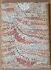
Imprint: London, Carington Bowles at his Map and Print Warehouse, No. 69, in St. Paul's Church Yard, 1785
Binding: Hardback Quarto (260 x 220 mm.), contemporary quarter calf, rebacked in cloth preserving the original boards. With typographic title and 44 copper engraved maps in early wash colour, in good condition.
This atlas was first published in 1767 as the 'Atlas Anglicanus' in response to Ellis popular 'English Atlas' first published in 1765. The 'Atlas Anglicanus' like many projects at the time began life by being published in monthly numbers. Each contained three maps with, apart from the first, the part numbers being engraved on them. Until recently no example of the parts issue had been located and the only evidence we had for its issue came from a contemporary account of Gough and two located adverts. Shortly after production began, Emanuel Bowen (c.1693-1767) died; his death on 8 May 1767 was reported in the 'London Magazine'. The project was continued by his son Thomas (c.1733-90) although the issues were becoming somewhat irregular towards the end. Near completion Thomas Kitchin (1718-84) stepped in and buys the rights to the atlas, the last part is issued with a title page indicating Kitchin as sole publisher. Kitchin was originally apprenticed to Emanuel Bowen in 1732 and would marry his masters daughter, Sarah, in 1739. Quite soon the pupils output became prolific including several high-quality English county atlases. Bowen was successful too and despite the death of Sarah in 1761 the ties between Bowen and Kitchin would remain close. But whilst Bowens wealth declined over the years Kitchin remarried in to a wealthy Baptist family. The maps are reductions of those published in the 'Royal English Atlas', themselves reductions of the 'Large English Atlas', both great atlases. Carington Bowles acquired the plates sometime before 1785 and immediately set about revising them. The titles are all changed, the imprints brought up to date and all now are numbered upper right to 44. The general map of the roads is omitted from this edition as is the leaf with contents which is now situated on the title page. The compass roses are now more uniform in style throughout and distances have been erased being replaced by those from London to the major cities. The atlas faced stiff competition from the continued presence of the Ellis atlas and the introduction of the hugely popular 'New and Correct English Atlas' by John Cary in 1787. Bowles priced his atlas at £1 16s, whilst the Ellis was 10s 6d and even the new Cary atlas was £1 10s. This atlas is therefore considerably rarer than that of the Cary. Provenance: private English collection acquired in 2015. Chubb (1927) 232; ESTC T301089; Hodson (1984-97) 256; Shirley (2004) T.Bow 5d; Worms & Baynton-Williams (2011).
Stock number:9782.
|
|
|
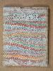
Imprint: London, 1785
Quarto (260 x 210 mm.), full contemporary quarter mottled calf, gilt ruled, rebacked with gilt ruled compartments, original calf gilt title label preserved. With typographic title and 44 copper engraved maps in early outline colour and yellow wash border, the general map in early wash colour, lower right corner of final map with some minor dirt, otherwise in good condition.
This atlas was first published in 1767 as the 'Atlas Anglicanus' in response to Ellisâ popular 'English Atlas' first published in 1765. The 'Atlas Anglicanus' like many projects at the time began life by being published in monthly numbers. Each contained three maps with, apart from the first, the part numbers being engraved on them. Until recently no example of the parts issue had been located and the only evidence we had for its issue came from a contemporary account of Gough and two located adverts. Shortly after production began, Emanuel Bowen (c.1693-1767) died; his death on 8 May 1767 was reported in the 'London Magazine'. The project was continued by his son Thomas (c.1733-90) although the issues were becoming somewhat irregular towards the end. Near completion, Thomas Kitchin (1718-84) stepped in and bought the rights to the atlas, the last part is issued with a title page indicating Kitchin as sole publisher. Kitchin was originally apprenticed to Emanuel Bowen in 1732 and would marry his masterâs daughter Sarah, in 1739. Quite soon the pupilâs output became prolific, including several high-quality English county atlases. Bowen was successful too and despite the death of Sarah in 1761 the ties between Bowen and Kitchin would remain close. But whilst Bowenâs wealth declined over the years Kitchin remarried in to a wealthy Baptist family. The maps are reductions of those published in the 'Royal English Atlas', themselves reductions of the 'Large English Atlas', both great atlases. Carington Bowles acquired the plates sometime before 1785 and immediately set about revising them. The titles are all changed, the imprints brought up to date and all now are numbered upper right to 44. The general map of the roads is omitted from this edition as is the leaf with a list of contents which is now situated on the title page. The compass roses are now more uniform in style throughout and distances have been erased being replaced by those from London to the major cities. The atlas faced stiff competition from the continued presence of the Ellis atlas and the introduction of the hugely popular 'New and Correct English Atlas' by John Cary in 1787. Bowles priced his atlas at £1 16s, whilst the Ellis was 10s 6d and even the new Cary atlas was £1 10s. This atlas is therefore considerably rarer than that of the Cary. Provenance: Bonhams, Oxford, 16 September 2014 lot 147; private English collection. Chubb (1927) 232; ESTC T301089; Hodson (1984-97) 256; Shirley (2004) T.Bow 5d; Worms & Baynton-Williams (2011).
Stock number:10182.
|
|
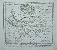
Imprint: London, c.1760
Edition: First Edition Folded and laid on linen and in attractive marbled board slipcases complete with the printed label of the original seller as published Printed for T. Bowles in St. Pauls Church Yard.
The maps from Emanuel Bowen and Thomas Kitchins beautiful 'Large English Atlas' were first issued separately. The project began at the hands of the publisher John Hinton in 1748 before he ran into financial difficulties. They are superb, clear and concise engravings. In the history of English county atlases it is hard to think of one with finer quality. Wardington praised the book saying that the size of the plate presented the publishers, the engravers and the printers with as formidable a task as any posed by the finest productions of Louis XIV or XV, the best of the Dutch engravings fifty years earlier, or the Ordnance Survey sheets fifty years later. Demand for folio maps of the English Counties in the early eighteenth century was mostly met by the old maps of Christopher Saxton, John Speed and various other seventeenth century maps. Individual large scale surveys were beginning to be published providing a ready source for accurate information. Hinton clearly saw a market for a fresh set of folio maps. In about 1748 Hinton employed the engravers Emanuel Bowen and Thomas Kitchin to engrave the maps. Hinton had already employed Bowen for the maps in the Universal Magazine from 1747. In May 1749 Hinton announced the publication of the map of Sussex and stated that the balance would be published at the rate of one a month. By 1752 or 1753 he sold his interest and the twenty-eight maps produced to date to the printseller John Tinney. By May 1756 he too felt the financial strains of the project and brought in the most successful printsellers of the time, Thomas Bowles, John Bowles and Son and Robert Sayer. Hodson 221 provides a thorough account of the complex history of this atlas, which was finally completed and issued with a title-page in c.1762. Because of the drawn out nature of the publication earlier states of some of the maps do exist. However the first edition c.1760 should contain maps in state a according to Hodson all bearing the names of the four partners. This example is in this first edition state a. Hodson (1984-97) II 221.
Stock number:5280.
|
|
Imprint: London, J. Tinney, R. Sayer, T. Bowles & J. Bowles & Son, c.1760
Edition: First Edition 540 x 700 mm., a very fresh example with large margins.
FIRST STATE in EXCELLENT CONDITION. The maps from Emanuel Bowen and Thomas Kitchins beautiful 'Large English Atlas' were first issued separately. The project began at the hands of the publisher John Hinton in 1748 before he ran into financial difficulties. They are superb, clear and concise engravings. In the history of English county atlases it is hard to think of one with finer quality. Wardington praised the book saying that the size of the plate presented the publishers, the engravers and the printers with as formidable a task as any posed by the finest productions of Louis XIV or XV, the best of the Dutch engravings fifty years earlier, or the Ordnance Survey sheets fifty years later. Demand for folio maps of the English Counties in the early eighteenth century was mostly met by the old maps of Christopher Saxton, John Speed and various other seventeenth century maps. Individual large scale surveys were beginning to be published providing a ready source for accurate information. Hinton clearly saw a market for a fresh set of folio maps. In about 1748 Hinton employed the engravers Emanuel Bowen and Thomas Kitchin to engrave the maps. Hinton had already employed Bowen for the maps in the 'Universal Magazine' from 1747. In May 1749 Hinton announced the publication of the map of Sussex and stated that the balance would be published at the rate of one a month. By 1752 or 1753 he sold his interest and the twenty-eight maps produced to date to the print seller John Tinney. By May 1756 he too felt the financial strains of the project and brought in the most successful print sellers of the time, Thomas Bowles, John Bowles and Son and Robert Sayer. Hodson 221 provides a thorough account of the complex history of this atlas, which was finally completed and issued with a title-page in c.1762. Because of the drawn out nature of the publication earlier states of some of the maps do exist. However the first edition c.1760 should contain maps in state a according to Hodson all bearing the names of the four partners. This example is in this first edition state a. Hodson (1984-97) II 221 & p. 128; Wyatt no. 30.
Stock number:7846.
|
|
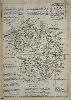
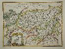
Imprint: London, 1767
325 x 230 mm., early outline colour, good condition.
The 'Atlas Anglicanus' was first issued in parts which is exceedingly rare and then as an atlas in 1767 republished in 1777. Emanuel Bowen (fl.1714 d.1767) was a very active engraver whose style is often noted by the extensive use of legends. Emanuel died during the issue of the parts and the work was continued by his son Thomas. However before it was completed Thomas Kitchin would take control of it. This rare example is in its first state. Skelton-Hodson 254.
Stock number:5742.
|
|
Imprint: London, 1761
160 x 190 mm., uncoloured, with two folds as issued in the book, in good condition.
From 'The General Magazine of Arts and Sciences'. Bowen was one of the finest engravers of the middle of the eighteenth century. The maps are sometimes attributed to a work entitled 'The Natural History of England, which is in fact a part of the General Magazine. Hodson no. 230.
Stock number:2549.
|
|
Imprint: London, Carington Bowles & Robert Sayer, c.1760
Edition: First Edition 540 x 700 mm., in fine old colour, with two small centrefold splits top and bottom, the lower one just 10 mm., into the margin, very light even toning otherwise in good condition.
The maps from Emanuel Bowen and Thomas Kitchins beautiful 'Large English Atlas' were first issued separately. The project began at the hands of the publisher John Hinton in 1748 before he ran into financial difficulties. They are superb, clear and concise engravings. In the history of English county atlases it is hard to think of one with finer quality. Wardington praised the book saying that the size of the plate presented the publishers, the engravers and the printers with as formidable a task as any posed by the finest productions of Louis XIV or XV, the best of the Dutch engravings fifty years earlier, or the Ordnance Survey sheets fifty years later. Demand for folio maps of the English Counties in the early eighteenth century was mostly met by the old maps of Christopher Saxton, John Speed and various other seventeenth century maps. Individual large scale surveys were beginning to be published providing a ready source for accurate information. Hinton clearly saw a market for a fresh set of folio maps. In about 1748 Hinton employed the engravers Emanuel Bowen and Thomas Kitchin to engrave the maps. Hinton had already employed Bowen for the maps in the Universal Magazine from 1747. In May 1749 Hinton announced the publication of the map of Sussex and stated that the balance would be published at the rate of one a month. By 1752 or 1753 he sold his interest and the twenty-eight maps produced to date to the printseller John Tinney. By May 1756 he too felt the financial strains of the project and brought in the most successful printsellers of the time, Thomas Bowles, John Bowles and Son and Robert Sayer. Hodson 221 provides a thorough account of the complex history of this atlas, which was finally completed and issued with a title-page in c.1762. Because of the drawn out nature of the publication earlier states of some of the maps do exist. However the first edition c.1760 should contain maps in state a according to Hodson all bearing the names of the four partners. This example is in state 6 of 8. Batten & Bennett 37 st. 6; Hodson (1984-97) II 221 p. 129 state g.
Stock number:6024.
|
|
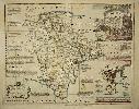
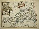
Imprint: London, 1767
230 x 325 mm., in good condition.
The 'Atlas Anglicanus' was first issued in parts which is exceedingly rare and then as an atlas in 1767 republished in 1777. Emanuel Bowen (fl.1714 d.1767) was a very active engraver whose style is often noted by the extensive use of legends. Emanuel died during the issue of the parts and the work was continued by his son Thomas. However before it was completed Thomas Kitchin would take control of it. This example is in its more usual second state. Not in Beaton; Skelton-Hodson 254.
Stock number:5744.
|
|
Imprint: London, c.1760
Edition: First Edition Folded and laid on linen and in attractive marbled board slipcases complete with the printed label of the original seller as published Printed for T. Bowles in St. Pauls Church Yard.
The maps from Emanuel Bowen and Thomas Kitchins beautiful 'Large English Atlas' were first issued separately. The project began at the hands of the publisher John Hinton in 1748 before he ran into financial difficulties. They are superb, clear and concise engravings. In the history of English county atlases it is hard to think of one with finer quality. Wardington praised the book saying that the size of the plate presented the publishers, the engravers and the printers with as formidable a task as any posed by the finest productions of Louis XIV or XV, the best of the Dutch engravings fifty years earlier, or the Ordnance Survey sheets fifty years later. Demand for folio maps of the English Counties in the early eighteenth century was mostly met by the old maps of Christopher Saxton, John Speed and various other seventeenth century maps. Individual large scale surveys were beginning to be published providing a ready source for accurate information. Hinton clearly saw a market for a fresh set of folio maps. In about 1748 Hinton employed the engravers Emanuel Bowen and Thomas Kitchin to engrave the maps. Hinton had already employed Bowen for the maps in the Universal Magazine from 1747. In May 1749 Hinton announced the publication of the map of Sussex and stated that the balance would be published at the rate of one a month. By 1752 or 1753 he sold his interest and the twenty-eight maps produced to date to the printseller John Tinney. By May 1756 he too felt the financial strains of the project and brought in the most successful printsellers of the time, Thomas Bowles, John Bowles and Son and Robert Sayer. Hodson 221 provides a thorough account of the complex history of this atlas, which was finally completed and issued with a title-page in c.1762. Because of the drawn out nature of the publication earlier states of some of the maps do exist. However the first edition c.1760 should contain maps in state a according to Hodson all bearing the names of the four partners. This example is in this first edition state a. Hodson (1984-97) II 221.
Stock number:5284.
|
|
Imprint: London, c.1760
Edition: First Edition Folded and laid on linen and in attractive marbled board slipcases complete with the printed label of the original seller as published Printed for T. Bowles in St. Pauls Church Yard.
The maps from Emanuel Bowen and Thomas Kitchins beautiful 'Large English Atlas' were first issued separately. The project began at the hands of the publisher John Hinton in 1748 before he ran into financial difficulties. They are superb, clear and concise engravings. In the history of English county atlases it is hard to think of one with finer quality. Wardington praised the book saying that the size of the plate presented the publishers, the engravers and the printers with as formidable a task as any posed by the finest productions of Louis XIV or XV, the best of the Dutch engravings fifty years earlier, or the Ordnance Survey sheets fifty years later. Demand for folio maps of the English Counties in the early eighteenth century was mostly met by the old maps of Christopher Saxton, John Speed and various other seventeenth century maps. Individual large scale surveys were beginning to be published providing a ready source for accurate information. Hinton clearly saw a market for a fresh set of folio maps. In about 1748 Hinton employed the engravers Emanuel Bowen and Thomas Kitchin to engrave the maps. Hinton had already employed Bowen for the maps in the Universal Magazine from 1747. In May 1749 Hinton announced the publication of the map of Sussex and stated that the balance would be published at the rate of one a month. By 1752 or 1753 he sold his interest and the twenty-eight maps produced to date to the printseller John Tinney. By May 1756 he too felt the financial strains of the project and brought in the most successful printsellers of the time, Thomas Bowles, John Bowles and Son and Robert Sayer. Hodson 221 provides a thorough account of the complex history of this atlas, which was finally completed and issued with a title-page in c.1762. Because of the drawn out nature of the publication earlier states of some of the maps do exist. However the first edition c.1760 should contain maps in state a according to Hodson all bearing the names of the four partners. This example is in this first edition state a. Hodson (1984-97) II 221.
Stock number:5290.
|
|
Imprint: London, c.1760
Edition: First Edition Folded and laid on linen and in attractive marbled board slipcases complete with the printed label of the original seller as published Printed for T. Bowles in St. Pauls Church Yard.
The maps from Emanuel Bowen and Thomas Kitchins beautiful 'Large English Atlas' were first issued separately. The project began at the hands of the publisher John Hinton in 1748 before he ran into financial difficulties. They are superb, clear and concise engravings. In the history of English county atlases it is hard to think of one with finer quality. Wardington praised the book saying that the size of the plate presented the publishers, the engravers and the printers with as formidable a task as any posed by the finest productions of Louis XIV or XV, the best of the Dutch engravings fifty years earlier, or the Ordnance Survey sheets fifty years later. Demand for folio maps of the English Counties in the early eighteenth century was mostly met by the old maps of Christopher Saxton, John Speed and various other seventeenth century maps. Individual large scale surveys were beginning to be published providing a ready source for accurate information. Hinton clearly saw a market for a fresh set of folio maps. In about 1748 Hinton employed the engravers Emanuel Bowen and Thomas Kitchin to engrave the maps. Hinton had already employed Bowen for the maps in the Universal Magazine from 1747. In May 1749 Hinton announced the publication of the map of Sussex and stated that the balance would be published at the rate of one a month. By 1752 or 1753 he sold his interest and the twenty-eight maps produced to date to the printseller John Tinney. By May 1756 he too felt the financial strains of the project and brought in the most successful printsellers of the time, Thomas Bowles, John Bowles and Son and Robert Sayer. Hodson 221 provides a thorough account of the complex history of this atlas, which was finally completed and issued with a title-page in c.1762. Because of the drawn out nature of the publication earlier states of some of the maps do exist. However the first edition c.1760 should contain maps in state a according to Hodson all bearing the names of the four partners. This example is in this first edition state a. Hodson (1984-97) II 221.
Stock number:5291.
|
|
Imprint: London, 1747
320 x 220 mm., in fine condition with modern wash colour
An attractive map of Moscovy, Russia, published in Emanuel Bowen's 'A Complete System of Geography'. Bowen was a successful engraver and publisher in London in the middle of eighteenth century. This is his finest world atlas. Phillips 603; Shirley BL Atlases T.Bow-2a 28.
Stock number:4119.
|
|
Imprint: London, 1752
350 x 470 mm., full recent wash colour, with publishers folds as issued, in good condition.
A fine attractive map of the Russian Empire by Emanuel Bowen. The fine baroque title cartouche and map were probably engraved by Thomas Kitchin. It was published in the 'Complete System of Geography'. Shirley T.Bow-2a no. 40.
Stock number:9633.
|
|
Imprint: London, 1747.
350 x 420 mm., with fine recent wash colour, with a double fold as issued, in good condition.
This finely engraved detailed map of the Indian peninsula and South East Asia was published in Emanuel Bowen's 'A Complete System of Geography', 1747. With a fine vignette. Phillips 603; Shirley BL T.Bow-2a 43.
Stock number:3793.
|
|
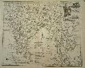
Imprint: London, Carington Bowles & Robert Sayer, 1750-[67]
540 x 700 mm., in early outline colour, with good margins, in good condition.
The maps from Emanuel Bowen and Thomas Kitchinâs beautiful 'Large English Atlas' were first issued separately. The project began at the hands of the publisher John Hinton in 1748 before he ran into financial difficulties. They are superb, clear and concise engravings. In the history of English county atlases it is hard to think of one with finer quality. Wardington praised the book saying that âthe size of the plate presented the publishers, the engravers and the printers with as formidable a task as any posed by the finest productions of Louis XIV or XV, the best of the Dutch engravings fifty years earlier, or the Ordnance Survey sheets fifty years laterâ. Demand for folio maps of the English Counties in the early eighteenth century was mostly met by the old maps of Christopher Saxton, John Speed and various other seventeenth century maps. Individual large scale surveys were beginning to be published providing a ready source for accurate information. In the case of Cornwall it was based on the exceedingly rare Joel Gascoyne of 1699. Hinton clearly saw a market for a fresh set of folio maps. In about 1748 Hinton employed the engravers Emanuel Bowen and Thomas Kitchin to engrave the maps. Hinton had already employed Bowen for the maps in the 'Universal Magazine' from 1747. In May 1749 Hinton announced the publication of the map of Sussex and stated that the balance would be published at the rate of one a month. By 1752 or 1753 he sold his interest and the twenty-eight maps produced to date to the printseller John Tinney. By May 1756 he too felt the financial strains of the project and brought in the most successful printseller's of the time, Thomas Bowles, John Bowles and Son and Robert Sayer. Hodson 221 provides a thorough account of the complex history of this atlas, which was finally completed and issued with a title-page in c.1762. Because of the long publication history of the atlas the maps all appear with several different imprints. That of Cornwall is found in eight states. This example is in Hodson's state g, the sixth state, reflecting the removal of John Bowles from the imprint below. This is best dated to 1767, the date of the earliest title page without his name. Hodson (1984-97) II 221 & p. 128; Quixley (1966) no. 31; Worms & Baynton-Williams (2011).
Stock number:9372.
|
|
Imprint: London, 1748
360 x 475 mm., a good example.
This map of Georgia is published just 15 years after the new colony's foundation by James Oglethorpe (1696-1785) in 1733. It is the first printed map to focus on Georgia. He was an active promoter of emigration to the colony and no doubt was behind this maps production. Evidence for this is in the title where the author Emanuel Bowen states he had access to 'original draughts assisted by the most approved maps and charts'. The original boundary of Georgia can be seen extending all the way westward to the Mississippi River. It was published in John Harris' 'A Complete Collection of Voyages and Travels' published in two volumes in 1744 and 1748, this appearing in the second. It includes the nascent settlements including Savannah and Ebenezer mostly huddled along the Atlantic coast. It is however for its interior detail that the map is justly desired. The internal settlements such as Argyle Fort and Mount Venture are outnumbered by the Indian settlements all of which are connected by a web of trails. The locations of the major tribes are also shown. A good example of a map often with offsetting or browning. Cumming, W.P. (SE) 267.
Stock number:7989.
|
|
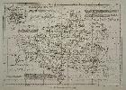
Imprint: London, c.1760
Edition: First Edition Folded and laid on linen and in attractive marbled board slipcases complete with the printed label of the original seller as published Printed for T. Bowles in St. Pauls Church Yard.
The maps from Emanuel Bowen and Thomas Kitchins beautiful 'Large English Atlas' were first issued separately. The project began at the hands of the publisher John Hinton in 1748 before he ran into financial difficulties. They are superb, clear and concise engravings. In the history of English county atlases it is hard to think of one with finer quality. Wardington praised the book saying that the size of the plate presented the publishers, the engravers and the printers with as formidable a task as any posed by the finest productions of Louis XIV or XV, the best of the Dutch engravings fifty years earlier, or the Ordnance Survey sheets fifty years later. Demand for folio maps of the English Counties in the early eighteenth century was mostly met by the old maps of Christopher Saxton, John Speed and various other seventeenth century maps. Individual large scale surveys were beginning to be published providing a ready source for accurate information. Hinton clearly saw a market for a fresh set of folio maps. In about 1748 Hinton employed the engravers Emanuel Bowen and Thomas Kitchin to engrave the maps. Hinton had already employed Bowen for the maps in the Universal Magazine from 1747. In May 1749 Hinton announced the publication of the map of Sussex and stated that the balance would be published at the rate of one a month. By 1752 or 1753 he sold his interest and the twenty-eight maps produced to date to the printseller John Tinney. By May 1756 he too felt the financial strains of the project and brought in the most successful printsellers of the time, Thomas Bowles, John Bowles and Son and Robert Sayer. Hodson 221 provides a thorough account of the complex history of this atlas, which was finally completed and issued with a title-page in c.1762. Because of the drawn out nature of the publication earlier states of some of the maps do exist. However the first edition c.1760 should contain maps in state a according to Hodson all bearing the names of the four partners. This example is in this first edition state a. Hodson (1984-97) II 221.
Stock number:5292.
|
|
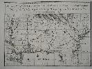
Imprint: London, c.1756
180 x 200 mm., with a small 5 mm. tear to upper margin repaired, otherwise in good condition.
From 'The General Magazine of Arts and Sciences'. Bowen was one of the finest engravers of the middle of the eighteenth century. The maps are sometimes attributed to a work entitled 'The Natural History of England, which is in fact a part of the 'General Magazine'. Hodson no. 230; Needell 18.
Stock number:5696.
|
|