 |
$US 119500.00
|
JEFFERYS, Thomas
The American Atlas: or, A Geographical Description of the Whole Continent of America Wherein are Delineated at Large, its Several Regions, Countries, States, and Islands; and Chiefly the British Colonies ... By the Late Mr. Thomas Jefferys, Geographer to the King, and others
Imprint: London, Robert Sayer and John Bennett, 1778-[79]
Edition:
First Edition
Binding:
Hardback
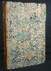
Folio (555 x 400 mm.), contemporary half calf, marbled boards. Ribbed spine with seven compartments, gilt ruled, with gilt calf title. Some moderate wear to the spine. With typographic title as transcribed above and index numbered to 30, with 23 maps (11 folding, 11 double-page and 1 single-page) numbered to 29 using 49 copper plates. All with early outline colour. Mounted on guards throughout. With water stain affecting map number 9. The condition of the maps is generally good, some light offsetting. There are a couple of minor creases as one would expect on a couple of the large folding maps.
A superb clean, strong example of an important atlas. Thomas Jefferys (1719-71) was arguably the most important English cartographer during the eighteenth century. A publisher, engraver, author and geographer of some note he was appointed Geographer to Frederick Prince of Wales in 1748, and later to King George III. It was during the Seven Years War that Jefferys made a name for himself as an authority on North American cartography. Many of those important maps are present in the atlas offered here. His other great contribution was in English County cartography being involved with a number of county atlases. But it was his large scale maps of the counties that extended his finances too far. His map of Devonshire in 1765 won the first ever prize of £100 offered by the Royal Society of Arts. By 1766 he was forced into bankruptcy. To survive Jefferys entered into partnerships, the most important of which was with the London map and printseller Robert Sayer. In 1768 his attention turned back to America when they published 'A General Topography of North America and the West Indies'. When Jefferys died in 1771, Sayer purchased a large amount of his stock. Sayer by then was in partnership with John Bennett. Together they continued to publish Jefferys maps, compiling amongst other atlases 'The American Atlas' offered here.This is arguably the first American state atlas displaying as it does for the first time all of the American colonies in great detail. Ristow stated that as a
major cartographic reference work it was very likely consulted by American, English and French civilian administrators and military officers during the Revolution. The first edition is dated 1775 with further issues in 1776, 1778, 1782, 1794 and 1800. The dates on the actual maps can be later than that on the title page. This is an example dated 1778 on the title page with the latest dated map being that of South America 1 July 1779. Amongst the significant maps included in this atlas are the surveys of the American continent in 6 sheets, Nova Scotia with Cape Breton Island, and New England by Braddock Mead (alias John Green), William Brasier's survey of Lake Champlain and the upper Hudson River valley, New York and New Jersey by Samuel Holland, the English edition of William Scull's map of Pennsylvania, Virginia by Joshua Fry and Peter Jefferson (father of Thomas, the third US President), the Carolinas by Henry Mouzon and Lieutenant Ross's map of the Mississippi River. A full list of contents is available. Provenance: private English collection acquired 1970s; private English collection. Harley, 'Imago Mundi' XX pp. 27-48; Howes J81; Phillips Atlases 3659a; Pritchard & Taliaferro p. 211; Ristow, Introduction to the facsimile edition (Amsterdam, Theatrum Orbis Terrarum, 1976); Sabin 35953; Shirley, BL T.JEF 2c; Streeter I 72.
Stock number:1937.
|