Item details: The Travelling Atlas of England and Wales with all the Railways and Coach Roads ...
£ 260.00
HEYWOOD, John
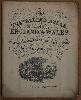
The Travelling Atlas of England and Wales with all the Railways and Coach Roads ...
Imprint: London, c.1881
Small quarto (240 x 195 mm.), original paper wrappers with title. With 45 lithographic maps back to back, including a large folding map of England and Wales. Light wear, generally in good condition.
This series of plates was first published by John Teesdale as the rare New Travelling Atlas in 1830. An even rarer edition of 1843 ensued. Lithographed derivatives were published by John Heywood from 1860. This example can be dated to c.1881 according to the railways depicted and each bears population figures derived from the 1871 census. Provenance: Dr. Adrian Almond collection. Carroll (1996) 92.K; Not in Chubb.