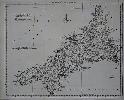
This map of Cornwall was first issued in 'Kitchin's Pocket Atlass', 1769. Kitchin is one of the most famous of the eighteenth century county map makers, he contributed to several works. Here Kitchin displays some fresh thought with an atlas in which all the maps are drawn to the same scale, indeed the title points this out 'Drawn to One Scale. By which the true proportion they severally bear to each other may be easily ascertained.' The stock of plates for the unsuccessful atlas came in to the possession of Carington Bowles who re-issued them as 'Bowles's Pocket Atlas', c.1778. Here we have an example from the second edition. Hodson 259; Quixley (1966) no. 31.