|
|

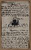
Imprint: Cologne, 1600
200 x 270 mm., with old colour, light soiling to margin otherwise in good condition.
An early map of the region of Alsace oriented to the west showing both sides of the upper Rhine River between Basel and Lahr. Engraved by Johann Bussemacher it is from Quad's 'Geographisch Handtbuch'. Meurer, P.H. (Cologne) Qua 16.
Stock number:5757.
|
|

Imprint: Cologne, 1592
210 x 300 mm., in fine outline colour, good condition.
A fine example of the Matthias Quad map of most of Switzerland engraved by Johann Bussemacher and published in Cologne. The map is drawn from the Abraham Ortelius of 1570, itself taken from the that of Aegidius Tscudi who was born in Glarus, Switzerland, in 1505. From 1524 he travelled extensively in the Alps and wrote a manuscript book with map of his travels. He intended to publish them but became involved in local politics instead. The map was printed separately in 1538 and no example survives. It is only known by a later re-print from the same block in 1560 which in itself survives in just one known example. Blumer pp. 58-9; Meurer Atlantes Colonienses Qua 3; Karrow 78/1; Weisz p. 83.
Stock number:4747.
|
|
|
Imprint: Cologne, 1600
195 x 290 mm., in good condition.
A fine example of the Matthias Quad map of Bavaria, Germany, engraved by Johann Bussemacher. It was published in 'Geographisch Handtbuch' in 1600 and orientated with north at the top. It is on a good scale extending from Nurnberg in the west to Ingolstatt and Regensburgh in the south. Meurer 'Atlantes Colonienses' Qua 6 no. 26.
Stock number:9724.
|
|

Imprint: Cologne, 1600
18 x 26 cms., a finely engraved dark impression
A fine example of the Matthias Quad map of most of Spain engraved by Johann Bussemacher. Published in Cologne it omits the extreme south of the Iberian peninsula. Meurer "Atlantes Colonienses" Qua 36.
Stock number:4060.
|
|

Imprint: London, 1845
15 x 18.5cm.In early wash colour.Complete with accompanying text.
The plates for 'Reuben Ramble's Travels through the Counties of England' were first issued as an exceedingly rare set of cards by Thomas Crabb in 1819. Then they appeared as the 'New Miniature Atlas' by Robert Miller in 1821 and by William Darton in 1822 and 1825. There most famous and desirable issue though is undoubtably as the lithographic atlas by the topographer Reuben Ramble. Intended for children each county map is surrounded by historical and decorative depictions. Chubb 517.
Stock number:2580.
|
|

Imprint: London, Darton and Clark, 1843
Quarto (205 x 165 mm.), one part (of five) contemporary paper wrappers, with ornate printed title to upper wrapper and advert to the lower one. Repaired spine. With 8 early wash coloured lithographic plates, 2 pasted to insides of the covers.
Reuben Ramble designed this atlas for children and it is now highly desired. The maps were originally published as a set of exceedingly rare card maps of the counties by Thomas Crabb. They were then issued by Robert Miller as the 'New Miniature Atlas' of 1821. Here Ramble surrounds the wide margins of the maps with a series of ornate vignettes. Ramble (1810-75), whose name is a pseudonym for the Reverend Samuel Clark, left his father�s business in 1836 and went to London. He soon became a partner to William Darton. He went on to write geography books for children and later in life became the Rector of Eaton-Bishop. The bibliographies normally place a date of c.1845 on this work however we have owned an example of the atlas bearing the ownership inscription dated 1843. Issued in five parts that offered here is of the Northern Counties which include Yorkshire, Cheshire, Cumberland, Derbyshire, Lancashire, Northumberland, Durham and Westmoreland. Carroll 74B; Chubb 517; Higham p. 87.
Stock number:1952.
|
|

Imprint: London, Darton and Clark., 1843.
Quarto (205 x 165 mm.), one part (of five) contemporary paper wrappers, with ornate printed title to upper wrapper and advert to the lower one. Repaired spine. With 8 early wash coloured lithographic plates, 2 pasted to insides of the covers.
Reuben Ramble designed this atlas for children and it is now highly desired. The maps were originally published as a set of exceedingly rare card maps of the counties by Thomas Crabb. They were then issued by Robert Miller as the 'New Miniature Atlas' of 1821. Here Ramble surrounds the wide margins of the maps with a series of ornate vignettes. Ramble (1810-75), whose name is a pseudonym for the Reverend Samuel Clark, left his father�s business in 1836 and went to London. He soon became a partner to William Darton. He went on to write geography books for children and later in life became the Rector of Eaton-Bishop. The bibliographies normally place a date of c.1845 on this work however we have owned an example of the atlas bearing the ownership inscription dated 1843. Issued in five parts that offered here is of the Midland Counties which include Oxfordshire, Herefordshire, Shropshire, Bedfordshire, Warwickshire, Staffordshire, Monmouthshire & Worcestershire. Carroll 74B; Chubb 517.
Stock number:1953.
|
|

Imprint: London, Darton and Clark, 1843
Binding: Hardback Quarto (215 x 175 mm.), full contemporary cloth, ornate blind ruling to boards, gilt embossed title to upper board, rebacked preserving original spine with gilt title. Five parts in one volume, with pictorial frontispiece and title, typographic title, Preface and 40 early wash coloured lithographic plates. The first two maps with some marginal waterstaining, some light offsetting as usual, otherwise a good example.
Reuben Ramble designed this atlas for children but it is now highly desired. The maps were originally published by Robert Miller as the 'New Miniature Atlas' of 1821. Prior to that they were utilised as a set of exceedingly rare card maps of the counties by Thomas Crabb. Here Ramble surrounds the wide margins of the maps with a series of ornate vignettes. The reference works normally place a date of c.1845 on this work however we have had examples with ownership inscriptions dated as early as 1843. Ramble, whose name is a pseudonym for the Reverend Samuel Clark (1810-75), left his father�s business in 1836 and went to London. He soon became a partner to William Darton. He went on to write geography books for children and later in life became the Rector of Eaton-Bishop. Provenance: 'From the Pailton Christmas Tree January 1870'. Carroll 74B; Chubb 517.
Stock number:7098.
|
|

Imprint: London, Darton and Clark, 1843
Binding: Hardback Quarto (210 x 170 mm.), one part (of five), with contemporary paper wrappers, with ornate printed title to upper wrapper with map vignette and advert to the lower one. With 8 early wash coloured lithographic plates, 2 pasted to insides of the covers. With modern quarter calf slipcase with marbled paper boards, title affixed and silk ties.
Reuben Ramble designed this atlas for children and it is now highly desired. The maps were originally published as a set of exceedingly rare card maps of the counties by Thomas Crabb. They were then issued by Robert Miller as the 'New Miniature Atlas' of 1821. Here Ramble surrounds the wide margins of the maps with a series of ornate vignettes. Ramble (1810-75), whose name is a pseudonym for the Reverend Samuel Clark, left his father�s business in 1836 and went to London. He soon became a partner to William Darton. He went on to write geography books for children and later in life became the Rector of Eaton-Bishop. The reference works normally place a date of c.1845 on this work however we have owned an example of the atlas bearing the ownership inscription dated 1844. Here we push the publishing date even further back as the ownership inscription is dated 1843. Provenance: original owner�s manuscript inscription �Harry Woodward Beckwith December 14th 1843�. Carroll 74B; Chubb 517.
Stock number:7745.
|
|
|
Imprint: London, Darton and Clark, 1843
Quarto (205 x 165 mm.), one part (of five) contemporary paper wrappers, with ornate printed title to upper wrapper and advert to the lower one. With 8 early wash coloured lithographic plates, 2 pasted to insides of the covers, each with accompanying leaf of descriptive text.
Reuben Ramble (1810-75) designed this atlas for children and it is now highly desired. The maps were originally published as a set of exceedingly rare card maps of the counties by Thomas Crabb circa 1819. They were then issued by Robert Miller as the 'New Miniature Atlas' of 1821. Here Ramble surrounds the wide margins of the maps with a series of ornate vignettes. Ramble's name is a pseudonym for the Reverend Samuel Clark who left his father�s business in 1836 and went to London. He soon became a partner to William Darton. He went on to write geography books for children and later in life became the Rector of Eaton-Bishop. The bibliographies normally place a date of c.1845 on this work however we have owned an example of the atlas bearing the ownership inscription dated 1843. Issued in five parts that offered here is of the Eastern Counties which include Cambridgeshire, Huntingdonshire, Norfolk, Rutland, Leicestershire, Lincolnshire, Nottinghamshire and Northamptonshire. Carroll (1996) 74B; Chubb (1927) 517.
Stock number:9943.
|
|
|
Imprint: London, Darton and Clark, 58 Holborn Hill, c.1844
Binding: Hardback Quarto (210 x 170 mm.), contemporary half calf, full contemporary red cloth, ornate blind ruling to boards, gilt embossed title to upper board, rebacked in matching cloth. With pictorial frontispiece and title, further letterpress title, Preface and 40 early wash coloured lithographic plates, some light offsetting as usual, otherwise a good example.
This work makes use of the process of lithography to draw from the exceedingly rare Thomas Crabb copper plates. Here the imprint and plate number are removed and railways added. The title is now plain without the panel and each now has a pictorial surround. As the Preface states the book is for the juvenile market and meant to be an ‘Introduction to the English Counties’. The vignettes illustrate ‘various topographical peculiarities and historical events, which will tend more effectually to fix the Counties on the recollection’. The accompanying text aims to ‘attain comprehensiveness and brevity’.William Darton Junior (1781-1854) was joined in 1830 by his son John Maw Darton (1809-81) and shortly after the name was changed to Darton & Son. The partnership was dissolved when William Darton retired in 1837. At some time around 1841 he was joined by the educationalist Samuel Clark (1810-75). He was born to a middle-class Quaker family in Southampton and unwillingly went to work for his father aged thirteen and a half as a brush and basket maker. Well read, he moved to London in 1836 before joining Darton in partnership. After matriculating from Magdalen Hall, Oxford, in 1839, he pursued both business and a degree. He wrote to fund his college expenses.He wrote under the pseudonym of Reuben Ramble and designed this atlas for children. The reference works normally place a date of c.1845 on this work, however it is made up of five parts, the southern and western parts of which we have had with ownership inscriptions dated December 1843. Indeed, this is supported by the fact that the 'Oxford Dictionary of National Biography' states ‘in 1843, he dissolved his partnership with Darton, and went abroad with Edward Strachey, visiting Italy and Greece’. He would go on to become the Rector of Eaton-Bishop.As referred to above the work was issued in parts. The five consist of Southern, Northern, Western, Midland and Eastern regions. Each contain 8 maps and their accompanying text. The Southern part commencing with Surrey is usually, but not always the first part. The ensuing order does vary. Provenance: with inscription on front free endpaper 'Mary ... Given her by her Grandmama Sep. 13. 1844'; private English collection. Beresiner (1983) pp. 96-7 & 183; Carroll (1996) 74A; Chubb (1927) 517; ODNB; Smith (1982) pp. 190-1; Tooley’s Dictionary (1999-2004); Worms & Baynton-Williams (2011).
Stock number:10254.
|
|

Imprint: London, Darton and Clark, c.1845
Binding: Hardback Quarto (215 x 170 mm.), rebacked preserving full contemporary cloth binding, blind and gilt embossed boards. Four separately issued works in one volume comprising: [Living and Moving, or Horses, Railways and Coaches]. 8 woodcut plates; [Birds, and their Uses to Man], 8 lithographed plates; [Reuben Ramble�s Travels in the Eastern Counties], 8 lithographed plates comprising a county map set within a pictorial border; [The Alphabet], 8 lithographed plates. In all 32 early wash coloured lithographic plates, 8 of English counties.
Reuben Ramble, whose name is a pseudonym for the Reverend Samuel Clark (1810-75), left his father�s business in 1836 and went to London. He soon became a partner to William Darton. He went on to write geography books for children and later in life became the Rector of Eaton-Bishop. Here is an example of a general knowledge book for children. One of the four parts found here is 'Reuben Ramble�s Travels in the Eastern Counties of England'. This was one of five parts that make up the desirable 'Reuben Ramble�s Travels through the Counties of England'. The maps were originally published as a set of exceedingly rare card maps of the counties by Thomas Crabb. They were then issued by Robert Miller as the 'New Miniature Atlas' of 1821. Here Ramble surrounds the wide margins of the maps with a series of ornate vignettes. Provenance: private English collection. Carroll (1996) 74B; Chubb (1927) 517.
Stock number:7294.
|
|

Imprint: Uxbridge, [1818]
Binding: Hardback Quarto (295 x 230 mm.), paper boards with paper label to upper cover 'Plates To The History of Uxbridge. [rule] By Redford & Riches', spine worn. With half title and 10 aquatint plates, 1 copper plate and 2 woodcut engravings. In good condition.
PROOF IMPRESSIONS in QUARTO FORMAT. George Redford and Thomas Hurry Riches published the 'History of the Ancient Town and Borough of Uxbridge' in octavo format with text in 1818. The verso of page xi of the Preface in that book states that 'Proof Impressions of the Plates, the Fac-Simile, & c. & c. on quarto paper, may be had of the publishers, in complete sets, price 15 shillings'. The plates are all nice dark impressions. Refer Anderson p. 177.
Stock number:8970.
|
|
Imprint: London, 1676
55 x 90 mm., in good condition.
THE INCREDIBLY RARE FIRST STATE from arguably the rarest and most desirable of the early playing cards done of the English counties. There are only three substantial collections of first state William Redmayne's known to survive. First published in 1676 with just outline suitmarks, the second state issued the following year contained vertical bars for red suits or cross-hatching for the black suits. Only one recorded complete pack in either state survives. Redmayne's cards were published just three months after those of Robert Morden and advertised in the Trinity Term catalogue as being for sale by �Redmayne at the Crown on Addle Hill; Henry Mortlock at the Phoenix, Robert Turner at the Star, in St. Paul�s Church-yard; H. Cox in Holborn; and B. Billingsley at the Printing Press in Cornhill�. Redmayne was a printer active between 1674 and 1719. In 1719 he was imprisoned for printing libel on the government and died in April in Newgate Prison of a fever. The maps on the Redmayne cards are smaller than those on the rival by Morden and are reminiscent of those thumb-nail maps by Matthew Simmons in 1635. Each map is accompanied by surrounding descriptive text on their respective commodities and points of interest. The Club suit mark bears the roman numeration 'III' nearby. Provenance: with manuscript ownership of 'Betty Browse' on the verso. Beresiner (2010) p. 18; not in Chubb; Higham (1997) p. 113; Hodson (1984) I no. 146; King (2003) p. 141; Mann, Sylvia and David Kingsley. (1972). 'Playing Cards Depicting maps of the British Isles, and of English and Welsh Counties', in The Map Collectors� Circle, no. 87 pp. 3-4, 18-19, App. II no. 4, App. III no. 3. pl. xii (listing all the cards); Skelton 96.
Stock number:9092.
|
|

Imprint: London, 1676
55 x 90 mm., in good condition.
THE INCREDIBLY RARE FIRST STATE from arguably the rarest and most desirable of the early playing cards done of the English counties. There are only three substantial collections of first state William Redmayne's known to survive. First published in 1676 with just outline suitmarks, the second state issued the following year contained vertical bars for red suits or cross-hatching for the black suits. Only one recorded complete pack in either state survives. Redmayne's cards were published just three months after those of Robert Morden and advertised in the Trinity Term catalogue as being for sale by �Redmayne at the Crown on Addle Hill; Henry Mortlock at the Phoenix, Robert Turner at the Star, in St. Paul�s Church-yard; H. Cox in Holborn; and B. Billingsley at the Printing Press in Cornhill�. Redmayne was a printer active between 1674 and 1719. In 1719 he was imprisoned for printing libel on the government and died in April in Newgate Prison of a fever. The maps on the Redmayne cards are smaller than those on the rival by Morden and are reminiscent of those thumb-nail maps by Matthew Simmons in 1635. Each map is accompanied by surrounding descriptive text on their respective commodities and points of interest. The Club suit mark bears the roman numeration 'VII' nearby. Provenance: collection of F. B. Swain, sold at Phillips, Norwich, 2 June 1993 lot 257; Burden Collection. Batten & Bennett (1996) no. 16.i; Beresiner (2010) p. 18; not in Chubb; Hodson (1984) I no. 146; King (2003) p. 141; Mann, Sylvia and David Kingsley. (1972). 'Playing Cards Depicting maps of the British Isles, and of English and Welsh Counties', in The Map Collectors� Circle, no. 87 pp. 3-4, 18-19, App. II no. 4, App. III no. 3. pl. xii (listing all the cards); Skelton 96.
Stock number:9093.
|
|

Imprint: London, 1676
55 x 90 mm., extreme upper left corner chipped, otherwise in good condition.
THE INCREDIBLY RARE FIRST STATE from arguably the rarest and most desirable of the early playing cards done of the English counties. There are only three substantial collections of first state William Redmayne's known to survive. First published in 1676 with just outline suitmarks, the second state issued the following year contained vertical bars for red suits or cross-hatching for the black suits. Only one recorded complete pack in either state survives. Redmayne's cards were published just three months after those of Robert Morden and advertised in the Trinity Term catalogue as being for sale by �Redmayne at the Crown on Addle Hill; Henry Mortlock at the Phoenix, Robert Turner at the Star, in St. Paul�s Church-yard; H. Cox in Holborn; and B. Billingsley at the Printing Press in Cornhill�. Redmayne was a printer active between 1674 and 1719. In 1719 he was imprisoned for printing libel on the government and died in April in Newgate Prison of a fever. The maps on the Redmayne cards are smaller than those on the rival by Morden and are reminiscent of those thumb-nail maps by Matthew Simmons in 1635. Each map is accompanied by surrounding descriptive text on their respective commodities and points of interest. The Heart suit mark bears the roman numeration 'II' nearby. Provenance: collection of F. B. Swain, sold at Phillips, Norwich, 2 June 1993 lot 257; Burden Collection. Beresiner (2010) p. 18; Carroll (1996) no. 16.i; not in Chubb; Hodson (1984) I no. 146; King (2003) p. 141; Mann, Sylvia and David Kingsley. (1972). 'Playing Cards Depicting maps of the British Isles, and of English and Welsh Counties', in The Map Collectors� Circle, no. 87 pp. 3-4, 18-19, App. II no. 4, App. III no. 3. pl. xii (listing all the cards); Skelton 96.
Stock number:9094.
|
|

Imprint: London, 1676
55 x 90 mm., light finger soiling, otherwise in good condition.
THE INCREDIBLY RARE FIRST STATE from arguably the rarest and most desirable of the early playing cards done of the English counties. There are only three substantial collections of first state William Redmayne's known to survive. First published in 1676 with just outline suitmarks, the second state issued the following year contained vertical bars for red suits or cross-hatching for the black suits. Only one recorded complete pack in either state survives. Redmayne's cards were published just three months after those of Robert Morden and advertised in the Trinity Term catalogue as being for sale by �Redmayne at the Crown on Addle Hill; Henry Mortlock at the Phoenix, Robert Turner at the Star, in St. Paul�s Church-yard; H. Cox in Holborn; and B. Billingsley at the Printing Press in Cornhill�. Redmayne was a printer active between 1674 and 1719. In 1719 he was imprisoned for printing libel on the government and died in April in Newgate Prison of a fever. The maps on the Redmayne cards are smaller than those on the rival by Morden and are reminiscent of those thumb-nail maps by Matthew Simmons in 1635. Each map is accompanied by surrounding descriptive text on their respective commodities and points of interest. The Diamond suit mark bears the roman numeration 'VIII' nearby. Provenance: 'Elizabeth Browse' found on the verso of others acquired with it. Beresiner (2010) p. 18; not in Chubb; Hodson (1984) I no. 146; King (2003) p. 141; Mann, Sylvia and David Kingsley. (1972). 'Playing Cards Depicting maps of the British Isles, and of English and Welsh Counties', in The Map Collectors� Circle, no. 87 pp. 3-4, 18-19, App. II no. 4, App. III no. 3. pl. xii (listing all the cards); Skelton 96.
Stock number:9095.
|
|

Imprint: London, 1676
55 x 90 mm., in good condition.
THE INCREDIBLY RARE FIRST STATE from arguably the rarest and most desirable of the early playing cards done of the English counties. There are only three substantial collections of first state William Redmayne's known to survive. First published in 1676 with just outline suitmarks, the second state issued the following year contained vertical bars for red suits or cross-hatching for the black suits. Only one recorded complete pack in either state survives. Redmayne's cards were published just three months after those of Robert Morden and advertised in the Trinity Term catalogue as being for sale by �Redmayne at the Crown on Addle Hill; Henry Mortlock at the Phoenix, Robert Turner at the Star, in St. Paul�s Church-yard; H. Cox in Holborn; and B. Billingsley at the Printing Press in Cornhill�. Redmayne was a printer active between 1674 and 1719. In 1719 he was imprisoned for printing libel on the government and died in April in Newgate Prison of a fever. The maps on the Redmayne cards are smaller than those on the rival by Morden and are reminiscent of those thumb-nail maps by Matthew Simmons in 1635. Each map is accompanied by surrounding descriptive text on their respective commodities and points of interest. The Heart suit mark bears the roman numeration 'IIII' nearby. Provenance: collection of F. B. Swain, sold at Phillips, Norwich, 2 June 1993 lot 257; Burden Collection. Beresiner (2010) p. 18; not in Chubb; Hodson (1984) I no. 146; King (2003) p. 141; Mann, Sylvia and David Kingsley. (1972). 'Playing Cards Depicting maps of the British Isles, and of English and Welsh Counties', in The Map Collectors� Circle, no. 87 pp. 3-4, 18-19, App. II no. 4, App. III no. 3. pl. xii (listing all the cards); Skelton 96.
Stock number:9096.
|
|

Imprint: London, 1676
55 x 90 mm., in good condition.
THE INCREDIBLY RARE FIRST STATE from arguably the rarest and most desirable of the early playing cards done of the English counties. There are only three substantial collections of first state William Redmayne's known to survive. First published in 1676 with just outline suitmarks, the second state issued the following year contained vertical bars for red suits or cross-hatching for the black suits. Only one recorded complete pack in either state survives. Redmayne's cards were published just three months after those of Robert Morden and advertised in the Trinity Term catalogue as being for sale by �Redmayne at the Crown on Addle Hill; Henry Mortlock at the Phoenix, Robert Turner at the Star, in St. Paul�s Church-yard; H. Cox in Holborn; and B. Billingsley at the Printing Press in Cornhill�. Redmayne was a printer active between 1674 and 1719. In 1719 he was imprisoned for printing libel on the government and died in April in Newgate Prison of a fever. The maps on the Redmayne cards are smaller than those on the rival by Morden and are reminiscent of those thumb-nail maps by Matthew Simmons in 1635. Each map is accompanied by surrounding descriptive text on their respective commodities and points of interest. The Heart suit mark bears the roman numeration 'IX' nearby. Provenance: collection of F. B. Swain, sold at Phillips, Norwich, 2 June 1993 lot 257; Burden Collection. Beresiner (2010) p. 18; not in Chubb; Hodson (1984) I no. 146; King (2003) p. 141; Mann, Sylvia and David Kingsley. (1972). 'Playing Cards Depicting maps of the British Isles, and of English and Welsh Counties', in The Map Collectors� Circle, no. 87 pp. 3-4, 18-19, App. II no. 4, App. III no. 3. pl. xii (listing all the cards); Skelton 96.
Stock number:9099.
|
|

Imprint: London, 1676
60 x 95 mm., in good condition.
INCREDIBLY RARE. This is from arguably the rarest and most desirable of the early playing cards done of the English counties. There are only three substantial collections of first state William Redmayne (fl.1674-1719, d.1719) cards known to survive. First published in 1676 with just outline suitmarks, the second state issued the following year contained vertical bars for red suits or cross-hatching for the black suits as seen here. Only one recorded complete pack in either state survives. Redmayne's cards were published just three months after those of Robert Morden and advertised in the Trinity Term catalogue as being for sale by ‘Redmayne at the Crown on Addle Hill; Henry Mortlock at the Phoenix, Robert Turner at the Star, in St. Paul’s Church-yard; H. Cox in Holborn; and B. Billingsley at the Printing Press in Cornhill’. Redmayne was a printer active between 1674 and 1719. In 1719 he was imprisoned for printing libel about the government and died in April in Newgate Prison of a fever. The maps on the Redmayne cards are smaller than those on the rival by Morden and are reminiscent of those thumb-nail maps by Matthew Simmons in 1635. Each map is accompanied by surrounding descriptive text on their respective commodities and points of interest. The Spade suit mark bears the roman numeration 'VIII' to the right. Provenance: private English collection. Beresiner (2010) p. 18; not in Chubb; Hodson (1984-97) I no. 146; King (2003) p. 141; Mann and Kingsley (1972) pp. 3-4, 18-19, App. II no. 4, App. III no. 3. pl. xii (listing all the cards); Skelton (1970) 97.
Stock number:9141.
|
|